Asking about Atlas Mountains weather is a bit like asking about the weather in a country rather than a single city — the answer depends heavily on where exactly you mean and how high up you’re talking about. A valley at 1,200 metres and a summit at 4,000 metres can have completely different conditions on the very same afternoon, and that’s really the central fact to understand before anything else.
This guide breaks down Atlas Mountains weather season by season, with specific attention to how altitude, rainfall, and regional position within the range all shift the picture. It’s pure climate data — temperatures, precipitation, and seasonal patterns across the High Atlas region.
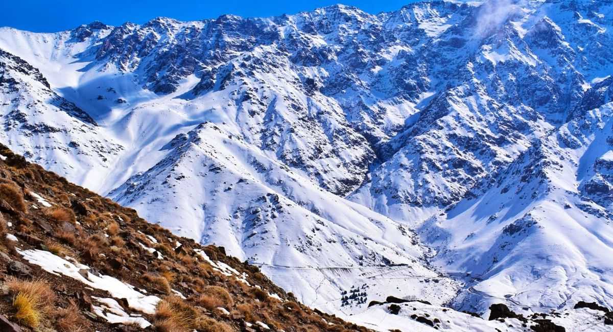
Why Atlas Mountains Weather Is Hard to Generalise
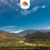
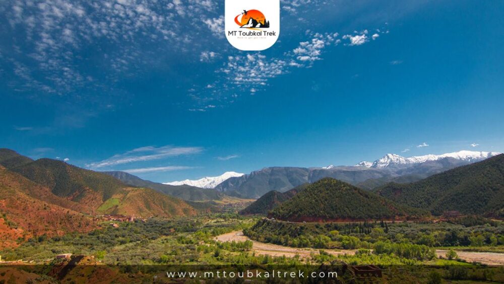
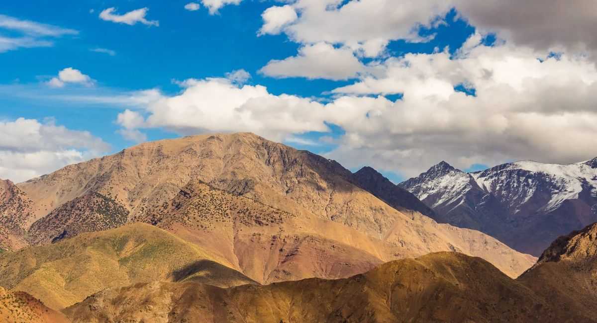
The Atlas range stretches roughly 2,500 kilometres across Morocco, Algeria, and Tunisia, but the section most travellers mean when discussing the weather is the High Atlas near Imlil and Jebel Toubkal. Even within this relatively contained area, elevation ranges from around 1,200 metres in the lower valleys to 4,167 metres at the summit of Toubkal itself, North Africa’s highest peak.
That elevation range creates genuinely distinct microclimates. Generally speaking, temperature drops by roughly 6-7°C for every 1,000 metres gained in elevation, meaning a warm spring day in the valley can coincide with near-freezing conditions at altitude on the exact same date. Rainfall patterns, wind exposure, and cloud cover also vary considerably depending on which side of the range you’re on and how exposed a particular valley is.
| “Ask what the weather is like in the Atlas Mountains, and the honest answer is always: at what elevation, and which side of the mountain?” |
Spring Weather (March – May)
| Spring [MAR – MAY] | ||||
| Spring brings one of the more dramatic seasonal transformations to the Atlas Mountains. Lower valleys warm steadily through March and April, with snowmelt feeding rivers and irrigation channels that have shaped Berber agriculture in the region for centuries. Wildflowers appear across the foothills by April, and almond and walnut trees blossom in the valleys around Imlil.
At altitude, the picture is quite different. Snow can still cover routes above 3,000 metres well into April, and the summit region around Toubkal often retains significant snow cover until May or even early June in heavier snow years. Daytime valley temperatures in spring typically range from 15-22°C, while the same days at altitude can sit closer to 0-8°C. Rainfall is moderate during spring, with occasional afternoon thunderstorms becoming more frequent as the season progresses, particularly in April and May. These storms tend to build quickly in the afternoon and clear by evening.
|
Summer Weather (June – August)
| Summer [JUN – AUG] | ||||
| Summer in the lower Atlas valleys gets genuinely hot, with July and August daytime temperatures regularly reaching 30-35°C in places like Imlil and the surrounding foothills. The dry, intense Mediterranean-influenced heat is similar in character to what’s experienced in Marrakech, though somewhat moderated by elevation and surrounding terrain.
Higher up, conditions remain noticeably cooler. Above 3,000 metres, summer daytime temperatures generally sit between 10-18°C, and the air thins enough that nights can still drop close to freezing even during the hottest months of the year. This is the one period where most snow has typically cleared from all but the very highest north-facing slopes near the summit. Summer is the driest season overall, with rainfall minimal across most of the range. Brief, localised thunderstorms do occur at higher elevations, often developing quickly in mid-afternoon and bringing short, intense downpours before clearing.
|
Autumn Weather (September – November)
| Autumn [SEP – NOV] | ||||
| Autumn brings a steady cooling trend across the range. September often still feels like an extension of summer in the valleys, with daytime temperatures around 24-28°C, gradually dropping through October and into November as the season progresses. Skies tend to be clearer and more stable than spring, with fewer of the sudden afternoon storms that characterise the wetter months.
At altitude, the shift toward winter conditions begins noticeably in October. Snow can start appearing on the highest peaks from late October onward, with the snow line gradually descending through November. By late November, temperatures above 3,000 metres regularly drop below freezing even during daylight hours. Rainfall begins increasing again from October, marking the start of the wetter half of the year that continues through winter and into spring. This makes autumn a transitional season climatically, moving from the dry stability of summer toward the more changeable conditions of winter.
|
Winter Weather (December – February)
| Winter [DEC – FEB] | ||||
| Winter is when the Atlas Mountains most resemble a genuine alpine environment. Valley temperatures during the day typically range from 8-15°C, mild by most standards, but nights regularly drop to near freezing or below, even at relatively low elevations like Imlil.
Above the snow line, which generally sits around 2,500 metres during winter, conditions become considerably more severe. Daytime temperatures at altitude often remain below freezing, and the summit area around Toubkal experiences sustained sub-zero conditions with regular snowfall. Wind chill at exposed high-altitude locations can make perceived temperatures feel significantly colder than the actual air temperature. Winter is the wettest and snowiest season for the range as a whole. Precipitation falls as rain in the lower valleys but as snow above roughly 2,000-2,500 metres, depending on the specific storm system. Snow accumulation at altitude can be substantial, with multi-metre depths common on north-facing slopes near the summit by late winter — relevant context covered further in our complete Toubkal trek guide.
|
How Altitude Changes Everything
The single biggest factor shaping Atlas Mountains weather on any given day isn’t the season — it’s elevation. The general rule of thumb in mountain climates is a temperature decrease of approximately 6-7°C per 1,000 metres of elevation gained, and the High Atlas follows this pattern closely.
| Elevation | Typical Conditions | Reference Point |
| 1,200-1,800m | Mild, Mediterranean-influenced | Imlil and lower valleys |
| 2,000-2,500m | Cooler, more variable | Mid-elevation trails |
| 2,500-3,200m | Snow line in winter, cold nights year-round | Toubkal Refuge area |
| 3,200-4,167m | Alpine, sub-zero common, severe in winter | Summit approach and Toubkal peak |
This is why the same calendar date can describe wildly different conditions depending on where exactly in the range you’re referring to. A genuinely warm spring afternoon in Imlil tells you very little about what’s happening at the Toubkal Refuge a few thousand metres higher on the same day — a gap covered in more practical detail in our Toubkal day trek guide.
Rainfall and Snowfall Patterns
Precipitation across the Atlas Mountains follows a clear seasonal pattern, concentrated heavily in the cooler months. November through April accounts for the large majority of annual rainfall and nearly all snowfall, while May through October is comparatively dry, with occasional afternoon thunderstorms providing the main exception, particularly at higher elevations during the warmer months.
Snowfall specifically depends almost entirely on elevation and timing. The snow line — the elevation above which snow reliably accumulates rather than melting on contact — typically sits around 2,500 metres in midwinter, dropping somewhat lower during particularly cold spells and retreating upward as spring progresses. The highest sections of the range, above 3,500 metres, can retain some snow patches even through summer in years with heavy winter accumulation.
| Worth noting: Localised weather in mountain terrain can shift quickly. Clear skies at a valley trailhead don’t guarantee the same conditions at a higher elevation a few hours later, and cloud or storm systems can develop with relatively little warning, particularly during the transitional spring and autumn months. |
Regional Variation Across the Range
The weather also varies meaningfully depending on which part of the Atlas range is being discussed. The area around Jebel Toubkal and Imlil, sitting closer to Marrakech, experiences a climate influenced by the semi-arid conditions of the plains below, with relatively low annual rainfall compared to sections of the range further west or north that catch more Atlantic moisture.
Areas further into the High Atlas, including regions around the M’Goun massif, can experience somewhat different precipitation patterns due to their position relative to prevailing weather systems moving across Morocco. North-facing slopes throughout the range generally retain snow longer than south-facing ones, since they receive less direct sun exposure through the cooler months. For context on how this region compares to other parts of the country, see our guide to the best places to visit in Morocco.
KEY TAKEAWAYS
| 1 | Atlas Mountains weather varies dramatically by elevation — roughly 6-7°C cooler for every 1,000 metres gained, regardless of season. |
| 2 | Summer brings hot valley temperatures (30-35°C) but much cooler conditions above 3,000 metres, where it can still drop close to freezing at night. |
| 3 | Winter is the wettest and snowiest season, with the snow line typically sitting around 2,500 metres and sub-zero conditions common at altitude. |
| 4 | November through April accounts for most of the range’s annual rainfall and nearly all snowfall. |
| 5 | Spring and autumn are transitional seasons, with spring seeing snowmelt and wildflowers, and autumn marking the steady return of colder, wetter conditions. |
| 6 | The highest peaks, including Jebel Toubkal, can hold snow cover well into May or June in heavier snow years. |
| 7 | Regional position within the range, slope orientation, and proximity to Marrakech’s semi-arid plains all add further local variation to the general seasonal pattern. |
Frequently Asked Questions
Does it snow in the Atlas Mountains?
Yes, regularly. Snow is common above roughly 2,500 metres from November through April, with the highest peaks like Toubkal often holding snow into May or June. Lower valleys such as Imlil rarely see snow settle for long, even in winter, since their elevation sits well below the typical snow line.
How hot does it get in the Atlas Mountains in summer?
Valley floors and lower foothills can reach 30-35°C in July and August. Temperatures drop noticeably with altitude, and areas above 3,000 metres stay considerably cooler, often 10-15°C lower than the valleys at the same time, with nights at high elevation still capable of dropping close to freezing.
What’s the rainiest time of year in the Atlas Mountains?
Most precipitation falls between November and April, with spring months sometimes bringing sudden afternoon storms. Summer is generally dry across the range, though brief, localised thunderstorms can occur at higher elevations, typically developing quickly in the afternoon.
How much colder is it at the top of Toubkal than in Marrakech?
Significantly colder. Marrakech sits at low elevation with a warm, semi-arid climate, while Toubkal’s summit at 4,167 metres can be 20-25°C colder than the city on the same day, and well below freezing for much of the year, particularly outside the summer months.
Conclusion
Understanding Atlas Mountains weather really comes down to grasping one core idea: elevation matters more than the calendar. A single day in the High Atlas can move through Mediterranean warmth in the valleys to alpine cold near the summit, and that compressed range of climates within a relatively small geographic area is part of what makes the region so distinctive.
Each season brings its own character — the snowmelt and wildflowers of spring, the dry valley heat of summer, the clear skies and cooling temperatures of autumn, and the genuine winter conditions that settle over the high peaks from December through February. None of these patterns is uniform across the whole range, though, and elevation, slope direction, and regional position all add further local variation to the broader seasonal trends described here.
For those wanting a deeper look at how this climate data translates into trip planning across Morocco’s Atlas Mountains more broadly, our best time to travel in Morocco guide covers how this fits alongside conditions elsewhere in the country, and our Atlas Mountains trekking tips guide builds on this climate data for those planning an actual route. MT Toubkal Trek has additional resources covering the region in depth — get in touch if you have specific questions about conditions for your travel dates.