When people first hear about the Atlas Mountains, the question that usually follows is simple: Where exactly are they?
The name sounds familiar, but the geography isn’t always clear. That’s why understanding a map of the Atlas Mountains in Africa makes such a difference. Once you see how the range stretches across the continent, the scale becomes obvious — and honestly, impressive.
This guide explains the Atlas Mountains location in simple terms, breaks down the regions across North Africa, and highlights the most important areas travelers and trekkers should know.
If you’re especially interested in the Moroccan section, the detailed Atlas Mountains Morocco guide gives a deeper look at trekking routes and travel options.
Atlas Mountains Africa: Where They Are Located
The Atlas Mountains Africa system stretches across the northwestern part of the continent. On a map, you’ll see the range running through three countries:
-
Morocco (western section)
-
Algeria (central section)
-
Tunisia (eastern section)
The entire mountain system extends for more than 2,500 kilometers, forming a natural barrier between the Mediterranean coast and the Sahara Desert.
In simple terms:
North of the mountains → Coastal plains and major cities
South of the mountains → Dry landscapes leading toward the Sahara
This geographic role is one reason the Atlas range is so important to North Africa’s climate and culture.
Why Morocco Appears Most on Atlas Mountains Maps
Although the range crosses three countries, Morocco is the most prominent on any travel-focused map of the Atlas Mountains in Africa.
That’s because Morocco offers:
-
The highest peaks
-
Established trekking routes
-
Easy access from major cities
-
Mountain villages and guesthouses
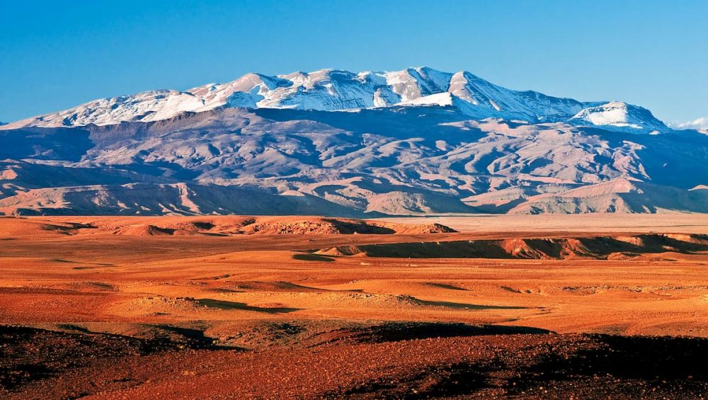
The highest peak in the entire range is Mount Toubkal (4,167 m), located in Morocco’s High Atlas.
Most treks begin in Imlil Village, about 1.5–2 hours from Marrakech.
8 Key Atlas Mountains Locations (Simple Map Guide)
1. High Atlas (Morocco)
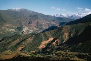
The most famous and dramatic part of the range.
Location: South of Marrakech
Highlights:
-
Mount Toubkal
-
Deep valleys and high passes
-
Traditional Berber villages
This is the main area for trekking and climbing. For a detailed climbing overview, see the Complete Travel Guide to Toubkal Trek.
2. Middle Atlas (Morocco)
Located between the High Atlas and the northern plains.
Landscape:
-
Cedar forests
-
Lakes
-
Rolling hills
Cities like Ifrane and Azrou sit within this region. It’s cooler and greener than many travelers expect.
3. Anti-Atlas (Morocco)
South of the High Atlas and closer to desert regions.
Features:
-
Rocky, dry terrain
-
Dramatic geological formations
-
Quiet, remote landscapes
Less visited, but very scenic.
4. Tell Atlas (Algeria & Tunisia)
This northern section runs parallel to the Mediterranean coast.
Characteristics:
-
Moderate elevations
-
Agricultural zones
-
Mediterranean climate
5. Saharan Atlas (Algeria)
Located south of the Tell Atlas.
This range forms part of the transition between northern Algeria and the Sahara Desert.
6. Mount Toubkal Area
On any map of the Atlas Mountains in Africa, Mount Toubkal stands out as the highest point in North Africa.
Typical trek:
-
2–3 days
-
Moderate to challenging
-
High altitude but non-technical in summer
7. Toubkal National Park
A protected area in the High Atlas.
Why it matters:
-
Main trekking routes
-
Mountain refuges
-
Alpine scenery
It’s the core adventure zone for travelers exploring the High Atlas.
8. Major Access Cities
When reading an Atlas Mountains location map, these cities act as gateways:
-
Marrakech → High Atlas
-
Fez → Middle Atlas
-
Agadir → Anti-Atlas
Marrakech is by far the most popular starting point for mountain trips.
Atlas Mountains Geography Explained Simply
The Atlas Mountains run roughly southwest to northeast across North Africa.
They serve three major roles:
-
Climate barrier – reducing desert winds in coastal areas
-
Water source – feeding rivers and agriculture
-
Cultural zone – home to Amazigh (Berber) communities
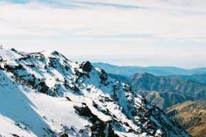
Many High Atlas villages remain accessible only by foot or mule, especially in remote valleys.
Best Atlas Region for Travel and Trekking
If you’re using a map of the Atlas Mountains in Africa to plan your trip:
Choose High Atlas if you want:
-
Mountain trekking
-
Mount Toubkal climb
-
Multi-day adventures
Choose Middle Atlas if you want:
-
Forest scenery
-
Easy hiking
-
Cooler temperatures
Choose Anti-Atlas if you want:
-
Remote landscapes
-
Desert proximity
-
Quiet travel
For most adventure travelers, the High Atlas is the best overall choice.
Best Time to Visit the Atlas Mountains
High Atlas
Spring and autumn are ideal for trekking. Winter brings snow at higher elevations.
Middle Atlas
Pleasant for much of the year.
Anti-Atlas
Best in winter and early spring to avoid extreme heat.
For seasonal planning, see Best Time to Travel in Morocco.
FAQ
Where are the Atlas Mountains located in Africa?
They stretch across Morocco, Algeria, and Tunisia in North Africa.
Which country has the highest Atlas Mountains?
Morocco, home to Mount Toubkal.
How long are the Atlas Mountains?
Over 2,500 kilometers.
Which Atlas region is best for trekking?
The High Atlas near Marrakech.
Conclusion
At first, the Atlas Mountains might seem like just another range on a map. But once you understand their scale and location, the picture changes. The range stretches across countries, shapes climates, and supports communities that have lived in these mountains for generations.
For travelers seeking adventure, culture, and high-altitude landscapes, the High Atlas region in Morocco stands out as the most rewarding part of the Atlas Mountains Africa system.